
History and surroundings
Village, parish precinct, monastery, pilgrimage and mill developed over centuries in close relationship with the landscape of the western Ries.
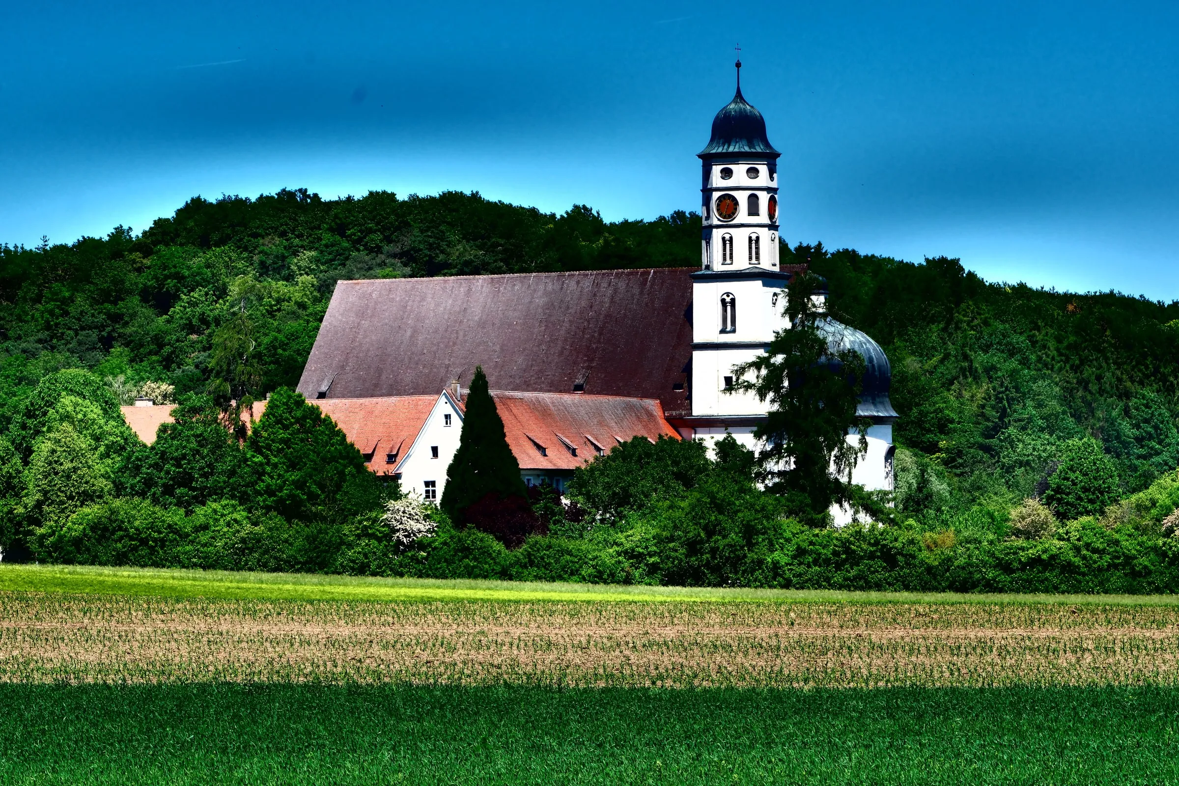
Maihingen’s history is not confined behind church doors. It lies in the course of its streets, old farm plots, the enclosed parish precinct, the path out to the monastery and the water of the Mauch. Village, church, fields and valley together form a historic cultural landscape. Much of it can still be read today; some interpretations of the earliest settlement retain a question mark.SourcesDr. Josef Hopfenzitz 1979a, pp. 7–11
Even the short walk from village to monastery changes perspective several times: farms and streets give way to open fields, the stream valley and wooded slope—then the great church becomes the destination.
Learning to read village and landscape
In 1979, Dr. Josef Hopfenzitz reconstructed Maihingen as an organically developed nucleated settlement characteristic of the Ries. In his interpretation, early farms clustered around a broad village green. Fertile fields lay to the north and east; three tracks descended towards the Mauch and its meadows. The wooded western slope supplied timber and stone. Exactly when the first farms appeared, and whether the place name really derives from an estate manager called “Mago”, remain the author’s scholarly interpretations.SourcesDr. Josef Hopfenzitz 1979a, pp. 7–8
Opposite the principal farm was another world: parish church, cemetery, glebe farm and parsonage formed the walled group that the publication calls the “sacred precinct”. Its wall visibly separated it from everyday life while also providing protection. As the village grew, large farm plots were more densely occupied and smallholdings appeared along the roads. The old plan thus remained legible even while houses, ownership and uses changed repeatedly.SourcesDr. Josef Hopfenzitz 1979a, pp. 7–10
No single lord controlled all of Maihingen. Secular and ecclesiastical lordships held farms and rights in the village. This mixture influenced which large holdings survived, were divided or were supplemented by smaller properties. Around 1800, Dr. Josef Hopfenzitz records about 140 households, making Maihingen a large village by the standards of the former Nördlingen district.SourcesDr. Josef Hopfenzitz 1979a, pp. 10–11
How Maria Mai began
West of the village, a chapel dedicated to St Anne became a place of pilgrimage. Tradition linked it to Count Johann of Oettingen’s rescue from mortal danger in 1405. Maihingen’s parish priest and dean, Konrad Rösser, promoted the pilgrimage and sought a religious community to care for it permanently. The initial foundation charter issued by the brothers Johann, Ulrich and Wilhelm, Counts of Oettingen, in 1437 began a long process.SourcesDr. Josef Hopfenzitz 2009, p. 4Dr. Josef Hopfenzitz 2013, pp. 147–148
Pilgrimage was not a fixed ritual that remained unchanged for centuries. Its meaning and intensity varied. The devotional worlds of successive religious communities joined Anne, Mary and the rescue story. The name Maria Mai held these layers together—and remained attached to both monastery and landscape.SourcesDr. Josef Hopfenzitz 2013, pp. 147–151
A monastery for women and men
Augustinians, Benedictines and Servites did not initially establish a lasting community. The foundation eventually passed to the order created by Bridget of Sweden. Charters of 1459 and 1472 secured it; the first sisters came from Gnadenberg in 1473, followed by the consecration of the church and solemn professions in 1481. Maria Mai was a double monastery: communities of women and men lived separately, both under an abbess. Maihingen later also supported the community at Altomünster.SourcesDr. Josef Hopfenzitz 1995, pp. 4–6
The Reformation, Peasants’ War and Schmalkaldic War hit the community hard. Fewer people entered, buildings and finances suffered, and the last sisters left around 1580. Their memory did not disappear: it endured in wells, field names and stories. Where later traditions even place Bridget herself resting near Maihingen, however, local memory must be distinguished from documented history.SourcesDr. Josef Hopfenzitz 1995, pp. 5–6
The Friars Minor build anew
The Friars Minor Conventual took possession in 1607. They celebrated worship, heard confessions, served the parish for a time and maintained a house of study. After the destruction of the seventeenth century, they reshaped the site: first came the conventual building of 1703–1706, then today’s monastery church in 1712–1719.SourcesDr. Josef Hopfenzitz 1995, pp. 6–10
A monastery, however, was more than a church and living quarters. Maihingen’s precinct included agricultural buildings, a brewery, brick barn, farms and mill. An eighteenth-century view presents them as a connected monastic landscape. Prayer, education and pastoral care met farming, craft and supply here—and the monastery became an important economic point of reference for the village.SourcesDr. Josef Hopfenzitz 1995, pp. 45–48Karl Gröber and Adam Horn 1938, pp. 289–291
What remained after 1802
The house of Oettingen-Wallerstein took possession of the monastery during secularisation in 1802. Religious life did not end overnight: some friars could initially remain or take on pastoral work. The buildings then found ever-new uses. A princely court occupied them from 1807 to 1820; the Wallerstein collections and a major library arrived in 1840. In 1946, the Augsburg diocesan Caritas association acquired church and buildings; in 1980, the books passed to the Free State of Bavaria and the University of Augsburg. The guide’s statements about uses after 1984 reflect the situation in 1995 and are not current visitor information.SourcesDr. Josef Hopfenzitz 1995, pp. 6–7, 45–47
Parts of the ensemble were opened for museum use in the late twentieth century. The Rieser Bauernmuseum opened in the former monastery brewery in 1984, followed by an agricultural building in 1994. These dates tell the story of the site’s development. Present opening hours, management and access should be checked with the responsible institutions. (Dr. Josef Hopfenzitz 2009, p. 5; Museum KulturLand Ries: history and development)
For information about today’s seminar house and its courses, visit Friendships and partnerships.
Water becomes work: the monastery mill
Further along the Mauch valley is a place where landscape quite literally performed work. The later monastery mill was originally called the Hagmühle. Dr. Josef Hopfenzitz identifies its first archival mention in Kaisheim monastery’s land register of 1319; an endowment of 1361 also refers to the mill. Still earlier origins remain conjectural. In 1437, Konrad Rösser bought the mill from the Teutonic Order and endowed it to the monastery. It remained connected with Maria Mai for 365 years, until 1802.SourcesDr. Josef Hopfenzitz 2019, pp. 9–14
The Mauch drove its machinery through a weir and mill leat. The building’s present appearance derives substantially from rebuilding in 1730. The 2019 study follows repairs and tenancies, miller families and technological change—through turbines and engines to the gradual end of milling for customers. It subsequently describes the mill as a place preserving historic milling and oil-milling technology. Here too, a historical account is not current information about visiting.SourcesDr. Josef Hopfenzitz 2019, pp. 19–24, 46–48, 51
History at every step
Josef Stimpfle recalls communal singing, evening craft work, festive clothing and customs within the church year. Such personal accounts are valuable testimony. Yet they always speak from a particular perspective and of particular decades—not of one unchanging form of “village life”.SourcesJosef Stimpfle 1979, pp. 21–23
Walking through Maihingen today, you can read this history as a sequence of spaces: from village green to parish precinct, out towards the monastery, past its agricultural buildings and on through the Mauch valley to the mill. Dates are not the only storytellers. Paths, sightlines, walls, water and the transition from village to countryside preserve memory too.
Every publication and page reference used here appears under Sources and literature.